Tuesday, December 7, 2010

Intelligent Dredging with GPS Lake Mapping

Save Significant Money on Dredging Projects!

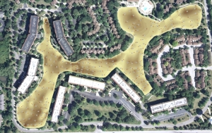
Integrated Lakes Management (ILM) recently completed a mapping project for a Chicago metro homeowners association.  The purpose of this project involved sediment monitoring for future dredging.  In order to avoid large costs and help property managers budget for sediment removal, ILM located the high priority areas of sediment accumulation and determined the need and location for dredging.  The mapping techniques utilized in this project helps ILM accurately calculate in-situ sediment volume and accumulation over time.  Thus, ILM is able to accurately isolate areas of high sedimentation for removal and help property managers budget accordingly.  This powerful information allows for smart management decisions and will save thousands of dollars in the future.

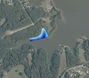
Map showing sediment depth. Individual depth points and color-shaded depth is shown. A great tool for understanding areas needing sediment removal.
More information on Integrated Lakes Management, Inc can be found on their website:  www.lakesmanagement.com

The Mapping Network:  www.TheMappingNetwork.com
A Nationwide Network of GPS Mapping Professionals

Monday, December 6, 2010

Nebraska Hunting Land For Sale: Sheridan County Sharptails

A New Home On 458 Acres, Great Location Just 4 Miles From Rushville, NE

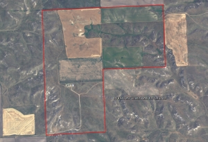
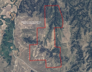
Here is a new home (finished in 2008) on 458 acres, great location just 4 miles into Rushville, NE (County seat). There is a commercial airport 30 miles west in Chadron, NE.  Chadron is also the home of Chadron State College.  There are approximately 110 acres of cropland, of which 40 is alfalfa and 70 is in wheat production, with the balance in grassland.  The home is approximately 2,100 sq. feet, with an unfinished basement. There are 3 bedrooms and 2 bathrooms with a large open kitchen. The home is situated on a hill with great views of the countryside. The last quarter of a mile of road is a private road  so there is no through traffic, nice privacy yet only minutes from town.  Recreational amenities include deer, coyotes, and there is a “booming ground” for sharptail grouse on the property. While touring the property, I saw approximately 70 sharptail grouse.

Contact Scott Saults, listing agent at scottsaults@hotmail.com or 308-289-1383

For More information on this listing click here: http://www.lashleyland.com/realestate/sheridan_sharptails.html

View other Nebraska hunting properties from Lashley Land: www.lashleyland.com

Aerial Map of Sheridan County Sharptails Listing in Sheridan County, Nebraska

Mike Lashley and Lashley Land & Recreational Brokers – A Real Estate Service Like No Other!
Nebraska Farm and Ranch Land For Sale – Cabela’s Trophy Properties

Nebraska River Land For Sale – Waterfowl, Deer and Turkey Hunting
All aerial, topography and location maps provided by The Mapping Network: www.TheMappingNetwork.com
A Nationwide Network of GPS Mapping Professionals

Need a Large Wall Map for your property or hunting area? The Mapping Network provides a low cost mapping product for the outdoor enthusiast!  Just let us know what area you want and we will print and ship a beautiful full-color wall map using the best aerial imagery available.

Create your own Aerial Maps here: Make My Own Map

Wednesday, December 1, 2010

Lake of the Ozarks Mile Marker Aerial Map

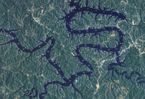
If you live on or visit the Lake of the Ozarks then you understand the importance of navigating the lake by Mile Markers.  The Mapping Network has created an aerial map of The Lake of The Ozarks with Mile Markers from the Truman Dam to the Bagnell Dam.  This map is offered is several sizes and formats.
To Order a Mile Marker Map of The Lake of the Ozarks click here:  Map Store

Lake of The Ozarks Mile Marker Aerial Imagery Map. Watermark is removed on printed map.
The Mapping Network is offering beautiful large format printings of your favorite recreational location.  If you have a lake home or cabin, there is no better accessory than a wall map of your lake!  Our color enhanced aerial imagery maps utilize the latest imagery available and are printed on industry leading printers and high quality photo or bond paper.   The Mapping Network provides a low cost mapping product for the outdoor enthusiast!

Pick your favorite lake, golf course or hunting location and have a high-quality 24 inch or 36 inch wall map printed for the home, office, or cabin.  This unique map will be enjoyed for many years to come.
Just let us know what area you want and we will print and ship a beautiful full-color wall map using the best aerial imagery available.  All for an amazing low price!
Click here to Order a Wall Map

Aerial Imagery Wall Maps for any lake, golf course, or property in the country!
For the Recreational Real Estate Market show your clients and buyers the entire property on one up-to-date full-color aerial map.  If you have hunting land for sale you want to know if that field, lake, or bluff is 1 acre, 10 acres, 100 acres or 10,000 acres of land.  This is a great way for real estate professionals to promote a listing in the office, on-site, or at an auction.  Take control of your listings and get a leg up on your competition.  Never underestimate the power of a professionally created map to generate buzz about your brokerage or listings.


The Mapping Network – Professional GPS /GIS Mapping and Printing

Tuesday, November 2, 2010

Why Lake Mapping? YouTube Video Explains Lake Bathymetry Benefits

Solitude Lake Management Company, a Lake Mapping Partner with The Mapping Network, offers the most technologically advanced lake mapping services available on the market, providing the most detailed and highest quality mapping products you can buy, for a very affordable price.   Click for examples of our lake mapping.
Equipped with the very latest in GPS surface mapping, bathymetry, 3-D contour imaging, aerial and fly-over video resources and virtual underwater swim-view 3-D mapping, we are able to add layers of depth to the information our customers seek. Whether you are tracking sedimentation, planning for dredging, looking to improve your fishery, or simply looking to understand the overall size, volume, and bottom contour of your pond in order to make good management decisions, we have the tools you need to be successful.

Solitude Lake Management Website on Lake Mapping:  http://www.solitudelakemanagement.com/services/lake-mapping/


Contact Solitude Lake Management here:  http://www.solitudelakemanagement.com/contact/

Find a Lake Mapping Service Provider Here:  Map My Lake

Questions about the lake mapping process and pricing?

E-mail us:  info@themappingnetwork.com

Lake Mapping Partner Makes Announcement

name change
Please visit Solitude Lake Management to view all their services including lake bathymetry.

http://www.solitudelakemanagement.com

Solitude Lake Management, a full service lake and pond management company, provides the most complete array of aquatic products and services in the market. We offer long term management solutions to the water quality problems faced by lakes and storm water ponds across the US. Contact us today for a free estimate on our services.

Solitude Lake Management restores the ecological balance to these ponds and provides clients with aesthetically pleasing water features that add to the value and enjoyment of their property, while still promoting sound environmental stewardship principles. No matter your location, or natural or man-made body of water, we can help you maintain the cleanliness and aesthetic beauty of your pond and promote healthy aquatic and plant life.


The Mapping Network:  www.themappingnetwork.com
 

Nebraska Land For Sale: Niobrara River Ranch

Here is a very nice ranch located on the Niobrara River in Western Nebraska.  Approximately 1/2 mile of both sides of the Niobrara River, 262 acres of farm ground with 62 acres that can be irrigated out of the river.  The balance of the land is sandhill pasture.  A very nice older home in immaculate condition overlooks the river in an end of the road setting.  This ranch would run approximately 100 cows year around.  The hunting on this ranch is great.  Merriman turkeys, antelope, mule deer, whitetail deer, sharptail grouse all can be found on the ranch.

For More information on this listing click here:  http://www.lashleyland.com/realestate/niobrara_river_ranch.html

View other Nebraska hunting properties from Lashley Land: www.lashleyland.com
 
Aerial Map of Niobrara River Ranch Listing in Sheridan County, Nebraska

Mike Lashley and Lashley Land & Recreational Brokers – A Real Estate Service Like No Other!
Nebraska Farm and Ranch Land For Sale – Cabela’s Trophy Properties

Nebraska River Land For Sale – Waterfowl, Deer and Turkey Hunting
All aerial, topography and location maps provided by The Mapping Network: www.TheMappingNetwork.com

A Nationwide Network of GPS Mapping Professionals

Need a Large Wall Map for your property or hunting area? The Mapping Network provides a low cost mapping product for the outdoor enthusiast!  Just let us know what area you want and we will print and ship a beautiful full-color wall map using the best aerial imagery available.

Create your own Aerial Maps here: Make My Own Map

This property is also listed on the exclusive Cabela’s Trophy Properties website.

Cabelas Hunting Land, Cabelas Land, Cabelas Land For Sale, Cabelas River, Cabelas Trophy Properties, GPS Map, Habitat, Hunting Land, Hunting Property, Land For Sale, Land Mapping, Lashley Land, Nebraska, Nebraska Hunting, Nebraska Hunting Land, Nebraska Land For Sale, Nebraska Waterfowl, River Land For Sale, The Mapping Network, Waterfowl

Related posts:

Tuesday, October 26, 2010

Western Nebraska Hunting Land For Sale

Ash Creek Wildlife – Nebraska Mixed Bag Hunting Property

This Little Piece of Heaven is a Hunter’s Paradise. Live Water and Cover Makes for Excellent Hunting.

This little piece of heaven has great potential. There is an old improvement site that has power run to it. A great opportunity to have a hunting shack. You could harvest wild turkey, mule deer, white-tailed deer, pheasants, quail and dove. Ash Creek starts on the land and runs through the property. Where could you get all this and have income as well. Come look soon as this one won’t last long.  

For More information on this listing click here: http://www.lashleyland.com/realestate/ashcreek_wildlife.html

View other Nebraska hunting properties from Lashley Land: www.lashleyland.com
 
Aerial Map of Ash Creek Wildlife Listing in Garden County, Nebraska

Mike Lashley and Lashley Land & Recreational Brokers – A Real Estate Service Like No Other!
Nebraska Farm and Ranch Land For Sale – Cabela’s Trophy Properties

Nebraska River Land For Sale – Waterfowl, Deer and Turkey Hunting
All aerial, topography and location maps provided by The Mapping Network: www.TheMappingNetwork.com
A Nationwide Network of GPS Mapping Professionals

Need a Large Wall Map for your property or hunting area? The Mapping Network provides a low cost mapping product for the outdoor enthusiast!  Just let us know what area you want and we will print and ship a beautiful full-color wall map using the best aerial imagery available.

Create your own Aerial Maps here: Make My Own Map

This property is also listed on the exclusive Cabela’s Trophy Properties website.

Blue Diamond Mallards – Nebraska Waterfowl Hunting

This Little Mallard Honey Hole Will Produce Consistent Awesome Mallard Shooting on the North Platte River. Add to That a Beautiful Crystal Clear 12 Acre Lake and You Have a Waterfowl Haven.

The crystal clear 12 acre lake is named Blue Diamond Lake. This part of the North Platte River winters thousands of ducks and geese. The lake provides refuge to the birds. Think if it, your own private refuge. Acrosee the river is the city of Scottsbluff, there is no hunting allowed. A warm water slough runs into the North Platte River on this property. This creates a meca for waterfowl shooting. There is a beautiful 1944 sq. ft. ranch style house that has slough development just a few feet from the back door. The owner recently registered an old irrigation well that can be used for additional water development. All this and only 5 minutes from downtown Gering or Scottsbluff. The Scottsbluff Airport has commercial flights daily from Denver and can handle privated jet aircraft.

For More information on this listing click here: http://www.lashleyland.com/realestate/bluediamond_mallards.html

View other Nebraska hunting properties from Lashley Land: www.lashleyland.com

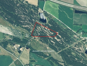
Aerial Map of Blue Diamond Mallards Property For Sale in Scottsbluff County, Nebraska
 
Mike Lashley and Lashley Land & Recreational Brokers – A Real Estate Service Like No Other!
Nebraska Farm and Ranch Land For Sale – Cabela’s Trophy Properties

Nebraska River Land For Sale – Waterfowl, Deer and Turkey Hunting
All aerial, topography and location maps provided by The Mapping Network: www.TheMappingNetwork.com
A Nationwide Network of GPS Mapping Professionals

Need a Large Wall Map for your property or hunting area? The Mapping Network provides a low cost mapping product for the outdoor enthusiast!  Just let us know what area you want and we will print and ship a beautiful full-color wall map using the best aerial imagery available.

Create your own Aerial Maps here: Make My Own Map

This property is also listed on the exclusive Cabela’s Trophy Properties website.

GPS Lake Map to Monitor Aquatic Vegetation

In the Pacific Northwest, Clean Lakes, Inc. and The Mapping Network have partnered to provide lake bathymetry and aquatic plant profile (biovolume).  Successful lake management requires an understanding of composition, depth and volume of your lake.  Tom McNabb,  President of Clean Lakes, Inc. with offices covering the west coast of the United States, had a client request an updated lake map to note current depths and mark aquatic vegetation.  Information gathered during the lake mapping process helped Mr. McNabb’s client better comprehend the density of aquatic plants over time in their lake.  The resulting map provided the baseline depth profile needed for long-term monitoring.


Deliverables for the project included printed maps, digital files (ArcGIS compatible of each waterbody with calculations of lake base volume and plant volume and biomass).

Lake Bathymetry with areas of dense floating vegetation highlighted

The Mapping Network:  www.TheMappingNetwork.com
A Nationwide Network of GPS Mapping Professionals

Virtual Fly Over on YouTube to Promote Recreational Real Estate Sales

Mike Lashley (Lashley Land & Recreational Brokers) utilizes every cutting edge technology to market his Nebraska recreational properties for sale.  Since a large number of buyers come from out of state or even hundreds of miles away in-state, it is critical to help potential buyers gain a feel for the land from their home or office before spending time and money to visit properties.  Mike Lashley has teamed up with The Mapping Network for all GPS and GIS mapping products to generate interest for his listings.  Using YouTube to show virtual flyovers of properties gives Mr. Lashley a significant competitive advantage in the recreational land market.

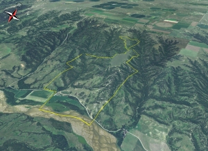
Nebraska Hunting Land For Sale - This Is One Amazing Piece of Nebraska Real Estate. 3/4 Mile of Niobrara River Frontage and Over 1 Mile of Lucky Creek Running Through the Ranch.

You will have to look long and hard to find a ranch like this one.  Niobrara River frontage, live creek water, secluded alfalfa fields and tremendous rugged canyon land that is 80% tree covered.  There are White-tailed Deer, Mule Deer, Merriams Wild Turkey all in abundance.

The ranch borders the Thomas Creek Wildlife Management Area.  This is over 1,000 acres of Public Land that is walk-in only hunting.  This makes it extremely hard for the Public to get to the back side.  It’s like having an extra 1,000 + acres to hunt.  What makes this one of the finest deer hunting spots is the 89 acres of alfalfa.  These fields are surrounded by tremendous bedding cover.  It’s a huge food plot that is miles from the nearest road.  I drove my Polaris Ranger within 40 yards of 4 White-tailed Deer.  They rarely see people.  There is a cozy 4 bedroom, 3 bath house with garage and a good metal building included.  The current owner would stay on as a tenant and caretaker.  More road development could be made to improve the ranch.  The current owner has the equipment and know how to do both.

For More information on this listing click here:  http://www.lashleyland.com/realestate/luckycreek_ranch.html

View other Nebraska hunting properties from Lashley Land: www.lashleyland.com
View Property Virtual Fly-Over on You Tube:  Click for Virtual Tour
Click her for Aerial Map (pdf): Aerial Map of Nebraska Hunting Land For Sale


Nebraska Hunting Land For Sale - This Is One Spectacular Piece of Nebraska Real Estate. 3/4 Mile of Niobrara River Frontage and Over 1 Mile of Lucky Creek Running Through the Ranch. Nebraska River Land For Sale – Waterfowl, Deer and Turkey Hunting
Nebraska Hunting Land For Sale – This Is One Spectacular Piece of Nebraska Real Estate. 3/4 Mile of Niobrara River Frontage and Over 1 Mile of Lucky Creek Running Through the Ranch. Nebraska River Land For Sale – Waterfowl, Deer and Turkey Hunting


The Mapping Network: www.TheMappingNetwork.com A Nationwide Network of GPS Mapping Professionals

Nebraska Hunting Land For Sale – This Is One Spectacular Piece of Nebraska Real Estate. 3/4 Mile of Niobrara River Frontage and Over 1 Mile of Lucky Creek Running Through the Ranch.
Nebraska River Land For Sale – Waterfowl, Deer and Turkey Hunting
Land Mapping, Cabelas Hunting Land, Cabelas Land, Cabelas Land For Sale, Cabelas River, Cabelas Trophy Properties, GPS Map, Habitat, Hunting Land, Hunting Property, Land For Sale, Lashley Land, Nebraska, Nebraska Hunting, Nebraska Hunting Land, Nebraska Land For Sale, Nebraska Waterfowl, River Land For Sale, The Mapping Network, Waterfowl

Kansas City Bathymetry and Property GPS Mapping

The Mapping Network and Absolute Natural Resources teamed up for a mapping project on the western edge of Kansas City, Kansas.  The client, a Home Owner Association, requested the creation of a detailed property and lake map which will then be distributed throughout the community.  Mapping the lake on the property allows for proper management of largemouth bass, crappie, blue gill and catfish populations by knowing exact depths and acreage for stocking densities and vegetation control.  Over 30 sediment depth samples were also collected in the field and placed on a separate map.  The maps are a handy tool for families and guests to the community by showing all trails and fishing hot spots.

Absolute Natural Resources provides extensive land and habitat GPS mapping services involving the use of complex data collection methods, state of the art GIS and GPS technology and satellite imagery.  Absolute Natural Resources offers a variety of mapping services and products for real estate professionals, private landowners, fishing and hunting clubs, habitat and lake developers, hunting lease managers, timber management firms, and recreational land companies.

Located in Denver, Colorado, Absolute Natural Resources has the experience to handle mapping projects in the steep terrain of the Rocky Mountains to the gentle hills of the Great Plains region.  Common client requests include, but are not limited to, aquatic vegetation beds, wetlands, streams, irrigation canals, inlet and outlet features, dam facilities, habitat structures, boat ramps, fishing piers, duck blinds, waterfowl nests and site-specific channels.

More information on Absolute Natural Resources, LLC can be found on their website:  www.anrwildlife.com


Aerial map showing lake depths, trails, and other features of the lake community

The Mapping Network:  www.TheMappingNetwork.com
A Nationwide Network of GPS Mapping Professionals
, , , , , , , , , , , , , , , , , , , , ,

GPS Lake Mapping in Action: Locating Trophy Bass in Georgia

Bathymetric Lake Mapping was performed by Greg Grimes with Aquatic Environmental Services for a homeowners association in a suburb of Atlanta, Georgia.  To read more about the mapping project click here.  During the mapping process in the field, Mr. Grimes was able to notice the main creek channel.  They made sure to collect plenty of data in this area and sure enough the maps showed a defined meandering creek channel.

Mr. Grimes discusses the lake mapping and fish shocking survey process: “When mapping we used our shock boat so knowing this service was part of our management services we performed this service upon completion of mapping.   We shocked up many good bass. The real hot spot was the meandering creek.  Luckily while mapping we tossed out a few marker buoys.  Many large bass floated up right near the markers of the creek channel.  One really cool thing that I would also like to share is that we tagged a bass at the boat ramp and 400 yards away it was shocked an hour later in the creek channel.  It is amazing in a 32 acre lake to get a bass we just shocked but even more amazing is how far the bass traveled in short time.”
So after the fish survey and mapping for the sedimentation it became clear they also were going to use this map for fishing.  During the data processing phase, The Mapping Network provided Aquatic Environmental Services a few GPS coordinates of the hotspots and now the residents can go back and find these locations.  Resident Phyllis Lea did just that; she took her granddaughter to the creek channel using the maps and knowledge it provided and had a morning to remember.

While bathymetric mapping might be primarily for monitoring sediment, never underestimate the power it can have for finding fish as well!

Combining the accuracy of GPS mapping technology and
professional electrofishing management techniques to
create a fishing hot spot map.  An example of the Trophy
Bass found in this lake in Georgia.
The Mapping Network provides the highest quality and is the most affordable bathymetric mapping system on the market today.  If you are serious about maintaining  a high-quality lake or pond, be sure you have the ability to make the best decisions,  get your lake mapped by the professionals at The Mapping Network.   Give us a call or send an e-mail to find out more details.
phone:  (402) 241-8177
e-mail: info@themappingnetwork.com
website: www.themappingnetwork.com

Aquatic Environmental Services, Inc offers a wide range of lake management and fisheries management services to residential, commercial, and private lake owners throughout Georgia and the southeast. We have been providing these quality services since 1996. AES has the experience and education necessary to provide unsurpassed lake and fishery services.  We have selected only the best products available for resale to our customers. Since the year 2000 we have performed services on over 2000 bodies of water.

Aquatic Environmental Services, Inc now has two divisions. Our Lake Management Division (LMD) emphasis is on maximizing the aesthetic appeal of a body of water while our Fishery Management Division (FMD) travels the southeast helping our clients grow big fish. Please visit these pages to find out more specific information on how we can help you with your lake management.

Our staff is comprised of three degreed fishery biologists. Mike Rosa heads LMD and has his B.S. in Fisheries from the University of Georgia. Matthew Morgan is supervisor for FMD and obtained his degree from the famed fishery management program at Auburn University. Greg Grimes, President of AES, obtained his masters in Fisheries from the University of Georgia in 1998 at which time he began the expansion of AES that continues today.

Aquatic Environmental Services, Bathymetric Map, Dredging, Fishing, Fishing Hot Spot Map, Georgia Bathymetry, Georgia Lake, Georgia Lake Map, Georgia Trophy Bass, GPS, GPS Lake, GPS Map, Habitat, Lake Management, Lake Map, Lake Mapping, Lake Survey, Sediment, Sedimentation, The Mapping Network, Trophy Bass Fishing
Posted in Lake Map | Tagged , , , , , , , , , , , , , , , , , , , ,

“Marsh Valley Roosters” Land For Sale in Cherry County, Nebraska

This Magnificent Tract of Sandhills Pasture and Marsh Holds More Pheasant Than I’ve Seen in a Long Time. This Tract of Sandhills Meadow is a Rare Nebraska “Fen”.

This range is loaded with Game!  While I was looking with the Seller I saw literally hundreds of pheasants.  We bumped 2 coveys of sharptail grouse, several mule deer, several white-tailed deer and a flock of mallards.

The Seller owns an additional 17,000 acres adjacent to this tract of ground.  In lieu of a cash lease on the ground, if the new Buyer wishes he would lease the rest of the ranch for exclusive hunting rights.  This ranch would have at least 4 more valleys like this one with one valley having 6 miles of the North Loup River running through it.  This is a great opportunity to have a unique piece of the Famed Nebraska Sandhills.  This tract is in the Heart of the Ogallala Aquifer.  There are 2 flowing artesian wells on the property that run 24-7.  There is a 1,000’ to 1,200 deep lake under this property.

This property is located adjacent west of “Horse Creek Fen” in Cherry County, Nebraska.  Not only does this marsh hold wildlife, but rare plants are also present.

For More information on this listing click here:  http://www.lashleyland.com/realestate/marshvalley_roosters.html
View other Nebraska hunting properties from Lashley Land: www.lashleyland.com


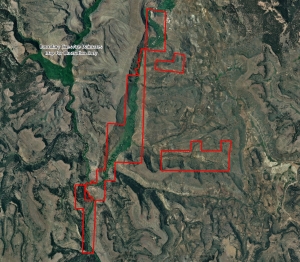
Aerial Map of Hunting Land For Sale in the Nebraska Sand Hills

Mike Lashley and Lashley Land & Recreational Brokers – A Real Estate Service Like No Other!
Nebraska Farm and Ranch Land For Sale – Cabela’s Trophy Properties

Nebraska River Land For Sale – Waterfowl, Deer and Turkey Hunting
All aerial, topography and location maps provided by The Mapping Network:  www.TheMappingNetwork.com
A Nationwide Network of GPS Mapping Professionals

Need a Large Wall Map for your property or hunting area? The Mapping Network provides a low cost mapping product for the outdoor enthusiast!  Just let us know what area you want and we will print and ship a beautiful full-color wall map using the best aerial imagery available.

Create your own Aerial Maps here: Make My Own Map

This property is also listed on the exclusive Cabela’s Trophy Properties website.

Posted in Land Mapping | Tagged , , , , , , , , , , , , , , , , , ,

Dallas – Fort Worth, Texas Lake Mapping

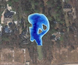
Bathymetric Lake Mapping was performed by Trent Lewis with Pond Medics, Inc., for a private homeowner in a suburb northwest of Dallas, Texas.  The purpose of this project was to create a base map of lake depths and locate areas of sediment accumulation.  The mapping techniques utilized in this project and subsequent lake mapping results allowed Pond Medics to devise an accurate resource management plan for the association.

Mr. Lewis says to “think of your lake map as a window into an unseen world. The lake map can be used to track changes in this dynamic environment. Use it as a planning and budgeting tool in your community. The sooner a lake is mapped, the more informed your lake management decisions will be.”
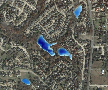
The finished project included a Bathymetric Lake Map with 3D Color-shaded depths and contour map with locations of high risk sediment areas.

Color-shaded depth map of a pond mapped by Pond Medics
For more information on Pond Medics, Inc. please contact:
Trent Lewis
phone: (972) 334-0104
e-mail:  info@pondmedics.com
website:  www.pondmedics.com

The Mapping Network:  www.TheMappingNetwork.com
A Nationwide Network of GPS Mapping Professionals

GPS Lake Map

GPS Bathymetric Lake Map

Lake Map,  Lake Mapping, Land Mapping, Lake Map, Bathymetric Map, Lake Management, Sediment, Dredging, Fishing, lake, Pond, map, New Jersey Lake, GPS Lake, Texas Lake, Texas Dredging, Sedimentation, Pond Medics, The Mapping Network, GPS, GIS, Survey, Lake Survey, GPS Map

Lake Bathymetry in St. Louis, MO

Using a GPS Lake Map to Create Management Plan

Jim Darlington, President of Leisure Ponds, mapped a  small pond in the St. Louis area for a residential Home Owners Association.
The pond surveyed was approximately 0.8 acres and had shown warning signs of significant sedimentation.  GPS Lake mapping was conducted on site to reveal the true lake depths of the ponds.  In addition to the bathymetric survey, sedimentation depths were collected and a model of sedimentation levels was created to estimate the volume of sludge in the lake.  During the mapping process, the HOA found out that the middle of the lake had roughly 6 to 7 feet of sedimentation accumulation.  This information provided the baseline depth profile needed for long-term sedimentation monitoring and dredging plans.  The mapping techniques utilized in this project allows Leisure Ponds to accurately isolate areas of high sedimentation for removal and help lake managers budget accordingly.

Contour map of a pond for a Home Owners Association in St. Louis, MO

Leisure Ponds specializes in improving the functional and aesthetic value of urban problem ponds.  For more information on Lake Mapping and Management in the St. Louis area please contact:
Jim Darlington
636-346-6228
www.leisureponds.com

Leisure Ponds

The Mapping Network: www.TheMappingNetwork.com A Nationwide Network of GPS Mapping Professionals

GPS Lake Map on YouTube Video

GPS Bathymetric Lake Map

View all Virtual 3D Lake Mapping on YouTube from The Mapping Network here: YouTube Videos

GPS Lake Map Guides Lake Management Plan

GPS Bathymetric Lake Mapping by The Mapping Network
On the surface, a lake or pond seems serene and effortless to maintain, but under the surface is a complex, dynamic organism requiring expert knowledge to produce a perfect balance.  To fully enjoy your lake or pond it is essential to know the facts.  Exact acreage, depths, and chemistry of your lake are critical factors for making the best management decisions.  Armed with this knowledge you will be able to properly place structure, deliver appropriate stocking densities, select the correct fish species, apply the right amount of weed control, and of course gain a better idea where those bass may be hiding!  The Mapping Network maps lakes throughout the entire year but typically the best time to map a lake is from fall until spring, while the weeds are down.  An accurate lake map provides the information needed to make the most of your aquatic resource.   The Mapping Network provides the highest quality and is the most affordable bathymetric mapping system on the market today.  If you are serious about maintaining  a high-quality lake or pond, be sure you have the ability to make the best decisions,  get your lake mapped by the professionals at The Mapping Network.   Give us a call or send an e-mail to find out more details.
phone:  (402) 241-8177
e-mail: info@themappingnetwork.com
website: www.themappingnetwork.com

Powerful, Proven Results:

Bathymetric Lake Mapping was performed by Trent Lewis with Pond Medics, Inc., for a homeowners association in a suburb northeast of Dallas, Texas.  The purpose of this project was to create a base map of lake depths and locate areas of sediment accumulation.  The mapping techniques utilized in this project and subsequent lake mapping results allowed Pond Medics to devise an accurate resource management plan for the association.
Mr. Lewis says to “think of your lake map as a window into an unseen world. The lake map can be used to track changes in this dynamic environment. Use it as a planning and budgeting tool in your community. The sooner a lake is mapped, the more informed your lake management decisions will be.”
The finished project included a Bathymetric Lake Map with 3D Color-shaded depths and contour map with locations of high risk sediment areas.

3D Lake Map
3D Color-Shaded Depth Map of a Series of Lakes
For more information on Pond Medics, Inc. please contact:
Trent Lewis
phone: (972) 334-0104
e-mail:  info@pondmedics.com
website:  www.pondmedics.com
The Mapping Network:  www.TheMappingNetwork.com
A Nationwide Network of GPS Mapping Professionals

Thursday, September 16, 2010

New Pond Design and Contruction

New Pond Construction by Wade Bales, Quality Lakes, Inc. – www.qualitylakes.com

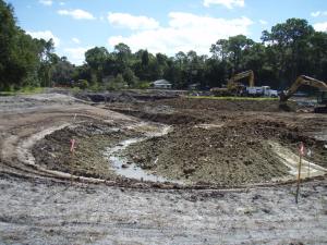
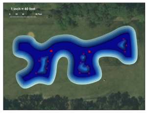
Quality Lakes Inc. was contracted to design a pond for a client to use as a back-up fishing location for their guests on days the St. John’s River was too rough for a guided trip.  The challenge was meeting the permit requirements for maximum surface acreage and maximum storage capacity which limited the overall size of the pond.  By utilizing the lake design tools available through our partnership with The Mapping Network, we were able to design a pond to meet permitting specifications while maximizing fish habitat and access by bank anglers to all regions of the pond.  Construction is underway and should be wrapped up in October.


New lake construction is well underway using the design created by Quality Lakes and The Mapping Network

Lake design created by Quality Lakes and The Mapping Network with an emphasis on creating a premium fishery

More information on Quality Lakes, Inc. can be found at their website: www.qualitylakes.com
The Mapping Network:  www.TheMappingNetwork.com
A Nationwide Network of GPS Mapping Professionals

GPS Lake Map
GPS Bathymetric Lake Map

Tuesday, September 14, 2010

Silvies River Ranch – Oregon Hunting Land For Sale

If 10 MILES of prime private river front property interests you,..look no further because this property is second to none!
 
Silvies River Ranch
2,595.00 Acres in Harney County, Oregon
$3,500,000
 
A 10 mile stretch of crystal clear River, slowly meanders through a long, lush green valley thriving with wildlife is the Silvies River Ranch. Homesteaded around the turn of the last century, the current ranch house was built in 1910 and last changed hands around 1941. This is a good indicator of how rare and special the Silvies River Ranch truly is. The 2595+/- deeded acres offers approximately 500 acres of irrigated pasture and additional out of the gate BLM grazing rights. The ranch is bordered by both public and private ground but remains very secluded due to the river valley terrain. In turn, this historic operating cattle ranch, is exceptionally situated with very limited access, proximity to an incredible amount of additional public grounds, miles of water, some of the best hunting in the state of Oregon and privacy that is second to none. The multiple tax lots, old homesteads and classic ranch house setting make the Silvies River Ranch a marker for which other ranches strive to be compared.

For More information on this listing click here:  http://www.landandwildlife.com/002LONE-PINE-ROADBURNSOregon/60677/ORWildlife

View other hunting properties in Oregon from Oregon Land and Wildlife:  www.landandwildlife.com


The possibilities are endless on the Silvies River Ranch!
Garrett Zoller: Growing up in Southern Oregon, I have thrived on the great outdoors. Water skiing, snowmobiling, upland bird and big game hunting, and fishing the Rogue River has brought me much happiness. Throughout high school and college, I faired well in football and wrestling while obtaining my Bachelors of Science degree in Business Administration and a minor in Criminology. Since graduation, I have owned a small business, as well as invested and worked in real estate; I married my college sweetheart, and we are currently raising our three children. Luxurious get-a-ways are not for us! Our familys first-choice escapes are the mountains, rivers and lakes of Oregon to the sandy beaches of the Oregon coast. My hands-on experience with recreational, agricultural, and timber properties combined with my expert knowledge of the state, provides valuable information to my clients in search of that perfect place. I value the opportunity to attend to your real estate needs. Teaming with Cabelas Trophy Properties is the ideal match for me and the Beaver State.

Address: 1245 Casino Road Medford, OR. 97501
Phone 1: 866-559-3478
Phone 2: 541-944-8821
Office:  866-559-3478
Email: garrett@landandwildlife.com
Website: www.landandwildlife.com 

All aerial, topography and location maps provided by The Mapping Network:  www.TheMappingNetwork.com

A Nationwide Network of GPS Mapping Professionals

This property is also listed on the exclusive Cabela’s Trophy Properties website.

http://www.cabelastrophyproperties.com/ViewDetail?id=60677

Buck and Bull Ranch – Oregon Hunting Land For Sale

Buck & Bull Ranch is located in the HEART of one of Oregon’s most prime hunting areas!
Buck & Bull Ranch
1,640.00 Acres in Harney County, Oregon
$1,605,000


Thriving with wildlife, the Buck and Bull Ranch last changed hands around the turn of the century. Mature timbered draws and Pine covered flats provide an exceptional habitat to access the multiple springs and water holes this ranch has to offer. Currently an operating cattle ranch, this 1640+/- acre tract provides incredible privacy, green valley ravines and scenery that movies are made of. Bordered by both public and private lands, this ground remains very secluded due to the terrain and proximity of surrounding private property. In turn, creating an opportunity to own some of the best hunting and recreational ground in the state of Oregon. During my first visit to this ranch, I saw MULTIPLE Elk, Deer, Antelope and coveys of quail; each with coveys of chicks. An ongoing list of chucker and additional species all call the Buck and Bull Ranch their home; truly meeting the criteria of what Trophy Properties is all about and a marker for which ranches strive to be compared.

For More information on this listing click here:  http://www.landandwildlife.com/0001LONE-PINE-ROADBURNS-OREGONOregon/60694/ORWildlife

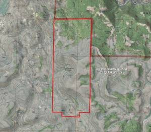
View other hunting properties in Oregon from Oregon Land and Wildlife:  www.landandwildlife.com 

Aerial and Topo Map of Buck and Bull Ranch


Garrett Zoller: Growing up in Southern Oregon, I have thrived on the great outdoors. Water skiing, snowmobiling, upland bird and big game hunting, and fishing the Rogue River has brought me much happiness. Throughout high school and college, I faired well in football and wrestling while obtaining my Bachelors of Science degree in Business Administration and a minor in Criminology. Since graduation, I have owned a small business, as well as invested and worked in real estate; I married my college sweetheart, and we are currently raising our three children. Luxurious get-a-ways are not for us! Our familys first-choice escapes are the mountains, rivers and lakes of Oregon to the sandy beaches of the Oregon coast. My hands-on experience with recreational, agricultural, and timber properties combined with my expert knowledge of the state, provides valuable information to my clients in search of that perfect place. I value the opportunity to attend to your real estate needs. Teaming with Cabelas Trophy Properties is the ideal match for me and the Beaver State.

Address: 1245 Casino Road Medford, OR. 97501
Phone 1: 866-559-3478
Phone 2: 541-944-8821
Office:  866-559-3478
Email: garrett@landandwildlife.com
Website: http://www.landandwildlife.com

All aerial, topography and location maps provided by The Mapping Network:  www.TheMappingNetwork.com
A Nationwide Network of GPS Mapping Professionals

This property is also listed on the exclusive Cabela’s Trophy Properties website.

Friday, September 10, 2010

Chautauqua County Kansas Hunting Land For Sale

Over 570 Acres of Kansas Whitetail Hunting Land For Sale in Chautauqua County

Premier Outdoor Properties has a new hunting property Chautauqua County, Kansas for sale.

Located in Chautauqua County, Kansas the “Buck Paradise Ranch” truly lives up to its name. This ranch supports a very large population of deer and turkey and trail cam photos confirm good numbers of trophy quality bucks. The ranch is heavily timbered with miles of hardwood covered ridge lines, hillsides, draws and creek bottom. Excellent topography provides the maximum concealment and seclusion that trophy bucks prefer and seek. Multiple tower blinds and ground blinds are located throughout the ranch. If you are looking for a fully developed prime hunting ranch with unmatched scenic views give us a call

Property Highlights:
  • Located in Chautauqua County, Kansas the “Buck Paradise Ranch” truly lives up to its name. This ranch supports a very large population of deer and turkeys and trail cam photos confirm good numbers of trophy quality bucks.
  • There are 120 +/- tillable acres planted in corn, soybeans and winter wheat providing year round nutrition and an additional 15 +/- acres of Imperial Whitetail Clover in 4 separate food plots. The ranch is heavily timbered with miles of hardwood covered ridge lines, hillsides, draws and creek bottom.
  • The topography on this ranch is excellent providing the maximum concealment and seclusion that trophy bucks prefer and seek. Agriculture is limited in this area and the isolated narrow cropland on this ranch can draw huge numbers of deer in the winter months.
  • Electric heat, stove/range, hot water heater and washer/dryer hookups are included. Water is provided from a well on the property. If you are looking for a fully developed prime hunting ranch with unmatched scenic views give us a call!
Estimated Acres:
572.5 +/- acres, (120 +/- tillable acres, 15 +/- food plot acres (4 plots), balance in timber,brush and tall grass.

Location/Directions:
10 miles NE of Sedan, Kansas.

For More information on this listing click here:  http://www.premieroutdoorproperties.com/viewlisting.php?returnstate=&searchstr=justlisted%3D45&listingid=252

View other hunting properties in Kansas, Iowa and Nebraska from Premier Outdoor Properties:  www.premieroutdoorproperties.com


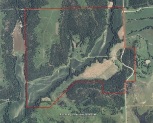
Aerial Map of the Buck Paradise Ranch located in Chautauqua County Kansas
Bill Holcomb is a native Kansan and salesperson for Premier Outdoor Properties Inc.. Bill’s love of the outdoors spans four decades and influenced his career decision to join the Cabela’s Trophy Property Team. For the last ten years Bill has enjoyed professionally guiding in eastern Kansas for Monster Whitetail’s and waterfowl. He has also had several trophy whitetail articles published in “North American Whitetail” and “Awesome Whitetails” magazines. “I’ve known since childhood that my calling was in the outdoors, it’s my life, it’s what I was born to do”. Bill is an avid waterfowler and is usually accompanied by his son Billy. He is also nationally known for consistently harvesting huge Kansas whitetails with a bow. With two bucks netting over 180 and ten netting between 151 and 193, Bill’s best six bucks accumulatively net 991 inches, an accomplishment that only a few hunter’s have surpassed with a bow or firearm. Bill has always felt that his greatest attribute as a trophy bow hunter is his ability to recognize trophy property. “I’m very fortunate to live in one of three best trophy whitetail states, I’ve spent untold hours in the field watching big deer and observing the habitat that they prefer”. With over thirty years of experience scouting out the best hunting opportunities Bill is certainly an expert in outdoor recreational property. He understands the dream of owning a great property. “The most rewarding part of my job is to look at the excitement in someone’s eyes when I know that I have played a part in making their dreams come true.”

All aerial, topography and location maps provided by The Mapping Network:  www.TheMappingNetwork.com

A Nationwide Network of GPS Mapping Professionals

This property is also listed on the exclusive Cabela’s Trophy Properties website.

Thursday, September 9, 2010

Smith Mountain Lake Benefits from Bathymetry Survey

Engineers Developing Dredging Plan and Dock Placement Select Local Expert for Bathymetry Study

Smith Mountain Lake is a gorgeous, 40-mile long, 20,600 acre lake, with 500 miles of shoreline, nestled in the Blue Ridge Mountains of rural southwestern Virginia.  Part of an ongoing improvement project required small sections ranging from 0.25 to 3 acres to be dredged due to sedimentation and safety issues.   Another area of the lake was preparing for the installation of several docks for the increase in boaters.  In both cases, accurate bathymetric lake mapping conducted by Virginia Lake Management and The Mapping Network was used as a tool for measuring lake depth and sediment volume to assist the lake in finding the best methods of dock placement and dredging techniques.  Engineers now have an updated basemap to monitor future sediment levels and keep boats traveling safely through the lake.

How accurate is your lake data? Did you know that many lake maps currently used by decision makers and the general public are either very old (often from the 1950′s) or were the original design plans (usually very inaccurate).  Don’t base your management and safety decisions on data that can be several feet off – have your lake mapped by the premier bathymetry survey providers in the country!  Only select companies undergo the detailed training provided through The Mapping Network.  This group of professional lake mappers have the local knowledge and reputation to proficiently map your lake.

Creating an accurate, up-to-date lake map of a cove. This information assists in construction and dredging plans by showing contractors and lake managers exactly what the bottom of the lake looks like.

More information on Virginia Lake Management can be found on their website:  www.virginialakemanagement.com

Kevin Tucker is the president of Virginia Lake Management Company, specializing in pond and lake management.  VLM also controls pond management interests in West Virginia, Pennsylvania, Maryland, Delaware, and North Carolina.

phone: (866) 697-2584
website:  www.virginialakemanagement.com
Color-Shaded Depth Map of a lake mapped by Virginia Lake Management
The Mapping Network:  www.TheMappingNetwork.com
A Nationwide Network of GPS Mapping Professionals

GPS Lake Map

GPS Bathymetric Lake Mapping

For the best results in mapping, it’s best to consult with a lake management company equipped with the very latest in GPS mapping technology.  Along with standard contour maps, The Mapping Network creates virtual media solutions on YouTube including a fly-over video and virtual underwater virtual swim-through.  With this knowledge, you can add layers of depth to the information you seek to maintain a beautiful lake.

Friday, August 20, 2010

Platte River Hunting Property For Sale

Trophy Whitetail Deer and Turkey – Near Maxwell, Nebraska on the Platter River

Both Side of a Platte River Channel. This Little Jewel has Tremendous Bedding Cover.
This little piece of heaven could provide a huge dividend in deer harvest.  It’s one of those places that attract whitetails.  There is cropland north and south of this property.  Game trails are abundant.  I bumped a nice Tom coming into the tract to take pictures.  I also think that one could have decent early season waterfowl hunting with the river and ponds that exist on the property.  All this at a very affordable price.

For More information on this listing click here:  http://www.lashleyland.com/realestate/mcpherson_whitetails.html

View other Nebraska hunting properties from Lashley Land: www.lashleyland.com


McPherson Whitetails Platter River Hunting Land For Sale near Maxwell, Nebraska
Mike Lashley and Lashley Land & Recreational Brokers – A Real Estate Service Like No Other!
Nebraska Farm and Ranch Land For Sale – Cabela’s Trophy Properties

Nebraska River Land For Sale – Waterfowl, Deer and Turkey Hunting

All aerial, topography and location maps provided by The Mapping Network:  www.TheMappingNetwork.com
A Nationwide Network of GPS Mapping Professionals

Need a Large Wall Map for your property or hunting area? The Mapping Network provides a low cost mapping product for the outdoor enthusiast! Just let us know what area you want and we will print and ship a beautiful full-color wall map using the best aerial imagery available.

Create your own Aerial Maps here: Make My Own Map

This property is also listed on the exclusive Cabela’s Trophy Properties website.

Thursday, August 19, 2010

Lake of the Ozarks Mile Marker Aerial Map

Lake of the Ozarks Mile Marker Aerial Map

If you live on or visit the Lake of the Ozarks then you understand the importance of navigating the lake by Mile Markers.  The Mapping Network has created an aerial map of The Lake of The Ozarks with Mile Markers from the Truman Dam to the Bagnell Dam.  This map is offered is several sizes and formats.

To Order a Mile Marker Map of The Lake of the Ozarks click here:  Map Store

Lake of the Ozarks Mile Marker Aerial Map

The Mapping Network is offering beautiful large format printings of your favorite recreational location.  If you have a lake home or cabin, there is no better accessory than a wall map of your lake!  Our color enhanced aerial imagery maps utilize the latest imagery available and are printed on industry leading printers and high quality photo or bond paper.   The Mapping Network provides a low cost mapping product for the outdoor enthusiast!

Pick your favorite lake, golf course or hunting location and have a high-quality 24 inch or 36 inch wall map printed for the home, office, or cabin.  This unique map will be enjoyed for many years to come.
Just let us know what area you want and we will print and ship a beautiful full-color wall map using the best aerial imagery available.  All for an amazing low price!

Click here to Order a Wall Map

Aerial Imagery Wall Maps for any lake, golf course, or property in the country!
For the Recreational Real Estate Market show your clients and buyers the entire property on one up-to-date full-color aerial map.  If you have hunting land for sale you want to know if that field, lake, or bluff is 1 acre, 10 acres, 100 acres or 10,000 acres of land.  This is a great way for real estate professionals to promote a listing in the office, on-site, or at an auction.  Take control of your listings and get a leg up on your competition.  Never underestimate the power of a professionally created map to generate buzz about your brokerage or listings.


The Mapping Network – Professional GPS /GIS Mapping and Printing

Wednesday, August 18, 2010

Hunting Ranch For Sale in Sheridan County, Nebraska

Trophy Whitetail Deer, Mule Deer and Elk – Beautiful Nebraska Pine Ridge Ranch: Approximately 788.58 Acres of Outstanding Hunting Ground

This is one of the best developed Nebraska Pine Ridge Ranches I’ve listed.  The owner is an extremely accomplished bow hunter.  He has strategically planted food plots throughout the ranch.  Most have level pads poured for ground blinds.  All of the food plots are fenced, keeping livestock out.  He has developed cross-fencing for pasture rotation.  There have been miles of underground water development providing excellent dependable water source for both livestock and wildlife.  I know of no other place where you can harvest trophy mule deer, white-tailed deer, bull elk and Merriams Wild Turkey on the same place.  In addition, there is a modest 4 bedroom log home on site as well as a 3 bedroom guest house that is very comfortable.  All this privacy and yet the ranch has U.S. Highway 87 frontage with locked gated entry.

For More information on this listing click here:  http://www.lashleyland.com/realestate/elk_meadows_ranch.html

View other Nebraska hunting properties from Lashley Land: www.lashleyland.com

Outstanding Nebraska Pine Ridge Ranch offers Trophy Whitetail, Mule Deer and Elk

Mike Lashley and Lashley Land & Recreational Brokers – A Real Estate Service Like No Other!
Nebraska Farm and Ranch Land For Sale – Cabela’s Trophy Properties

Nebraska River Land For Sale – Waterfowl, Deer and Turkey Hunting

All aerial, topography and location maps provided by The Mapping Network:  www.TheMappingNetwork.com

A Nationwide Network of GPS Mapping Professionals

Need a Large Wall Map for your property or hunting area? The Mapping Network provides a low cost mapping product for the outdoor enthusiast!  Just let us know what area you want and we will print and ship a beautiful full-color wall map using the best aerial imagery available.

Create your own Aerial Maps here: Make My Own Map

This property is also listed on the exclusive Cabela’s Trophy Properties website.